
Design Overview
Helios allows you to quickly create an accurate digital design of a solar system (The Digital Twin) by making the most of different map layers and data sources.
Once the digital twin is created, it is used as the foundation for all future activities in Helios covering the entire system lifecycle.
- End Customer Offers
- Material Lists and purchasing
- System Reports
- String and Ballast Plans
- Commissioning Forms
- Pro-Active Monitoring
- Intelligent Alerting
- Performance Reports
- Documentation System
A normal project cycle follows the steps below
- Create a Project and System (See Getting Started below)
- Create Areas on maps
- Lay modules within Areas
- View results and optimize
- Generate End Customer Offers and Material Quotes.
- Install system
- Register and verify system
- Guarantee Issued
- Maintain system performance
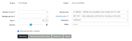
To create a new system;
- Log in to https://helios.autarco.com/
- Go to Projects -> Create New Project or click on Create New Project from the home page.
- Enter Project Reference. Click Save & Create System
- Enter system properties. Mandatory fields indicated by an asterix are;
- Install Address: City and Country
- If a guarantee is to be issued, additional fields, marked with a shield icon, are mandatory before completing registration. These can be entered later.
- You now have multiple options to continue with your system deisgn.
- Save
- Save & Design on maps
- Save & design with form
This will save the project without designing a system. Reasons to do this might be;
- To create a custom set of materials to purchase that is not based on a specific system design. i.e. additional items or a bulk order.
- To come back and design the system later.
This is the most reliable and efficient way to create the digital twin. View the intended location for a PV system with the help of up-to-date map material and aerial photos.
Map layer availability and quality vary by region. The availability of height maps impacts the initial design process. Helios will determine whether height maps are available or not and guide you through the relevant setup.
Height maps are currently available in the Netherlands and parts of Belgium.
For the next steps in the Design process see;
Use this option if you don’t want to use a visual map layer to design. You can design PV Arrays by selecting number of rows and modules per row.
A PV array is a set of solar modules arranged in a rectangle. An array has a number of rows, with a number of modules in each row. Each row has the same number of modules. The distance between modules in the same row is the thickness of our mid clamps; the distance between rows depends on the mounting system.
All modules in an array are of the same module type, use the same mounting system, and share the same row distance, pitch, azimuth and orientation (portrait or landscape). The rows in an array always run horizontally (level or nearly level) and in the direction perpendicular to the azimuth.
Shade simulation is not possible when the system is designed with form. On the yield page you can select different shade profiles;
- Shade Free
- Off-peak shade: Assumes full shade before 9AM and after 4PM.
- Peak Hours: This is not possible to predict and accurate yield.
Related Links
Still need help? Please raise a case in Helios